
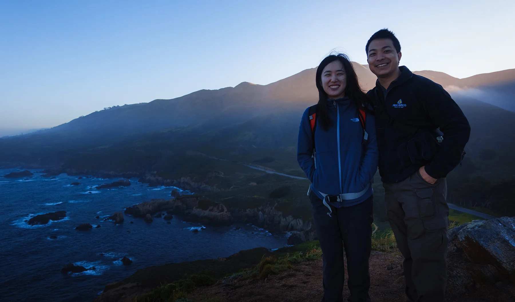
The next morning, we’re up early and on the road again, heading back north to Soberanes Point in the deep blue of the pre-dawn light. Hemmed in as it is by the towering Santa Lucia Range to its immediate east, Big Sur is no trivial place for sunrise photography. In my pre-trip research, I had a hard time finding suggestions for sunrise spots and compositions. Even longtime area photographers seemed to suggest that the Pacific coastline, though rife with sunset opportunities, would be a fool’s errand at daybreak, when its seascapes would be shadowed by the mountains and the ubiquitous layer of marine fog. Short of climbing the range (which Jane and I had neither the time nor the equipment to do), we would have to get creative. Fortunately, after a lot of time spent simulating sunrises in Google Earth, I hit upon a location that I hoped would provide interest: the top of the Whale’s Hump across from Soberanes Canyon, an elevated location between the mountains and the sea. Just a brief climb from the trailhead below, its north-northeast-facing ridge would provide a leading line into the frame and, if conditions were ideal, would be backed by early morning sidelight streaming over the saddle above Soberanes Canyon. Quite happily for us, the location worked perfectly.
After about half an hour of driving and a quick roadside stop above the beach near Point Sur, we park on a dirt shoulder at the foot of the hill, just a few hundred yards south from the cypress grove we passed through on the previous day. A short trail takes us up a well-maintained series of dirt steps, under the branches of a sprawling Monterrey pine, and to the ridge at the top of the hump. We arrive just as the sun is beginning to crest the range, its light diffused by low-hanging clouds on the seaward slopes of the mountains, so that the canyon below is bathed in an ethereal golden glow. Jane climbs to the summit while I take photos of her from the opposite end of the hill; after awhile, we switch positions, and I photograph her facing southward, framed by the open ocean. From the top of the Whale’s Hump, we gaze down on a terrific panorama of the rocky coves and coastal bluffs that we explored the previous afternoon. As the dawn filters through the mountains, it strikes the headlands in patches of dappled light - verdant greens and golds appear on the land, as if lit by a spotlight. Truly one of the loveliest sights of our entire trip, and a sunrise well worth the effort and planning that went into it.


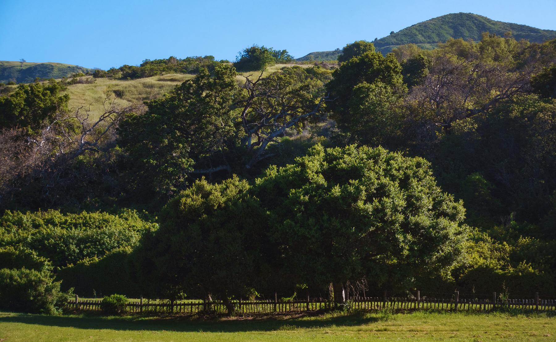
The morning has arrived in full by the time we return to the car. Jane feeds me pea snacks as we drive back south, stopping just before the entrance to Big Sur Valley at Andrew Molera State Park, a sprawling coastal acreage of campgrounds and meadows, wind-swept bluffs, and oak groves abutting the Big Sur River as it flows toward the tidal lagoon where it meets the sea. Unfortunately, most of the trails to the west are inaccessible to us, as the footbridge across the river has not yet been installed for the season. We make do with a short stroll down the Bobcat Trail, a flat dirt path along the eastern bank of the river, which takes us past the derelict buildings of the old Molera Ranch - now converted into a historic museum and a headquarters for the Ventana Wildlife Society. Jane and I spend the morning birding and taking photos of the ranch’s beautiful, century-old oak trees, which stand majestically against hillsides of coastal scrub beneath a brilliant sun - the classic chaparral landscape that so completely embodies coastal California.
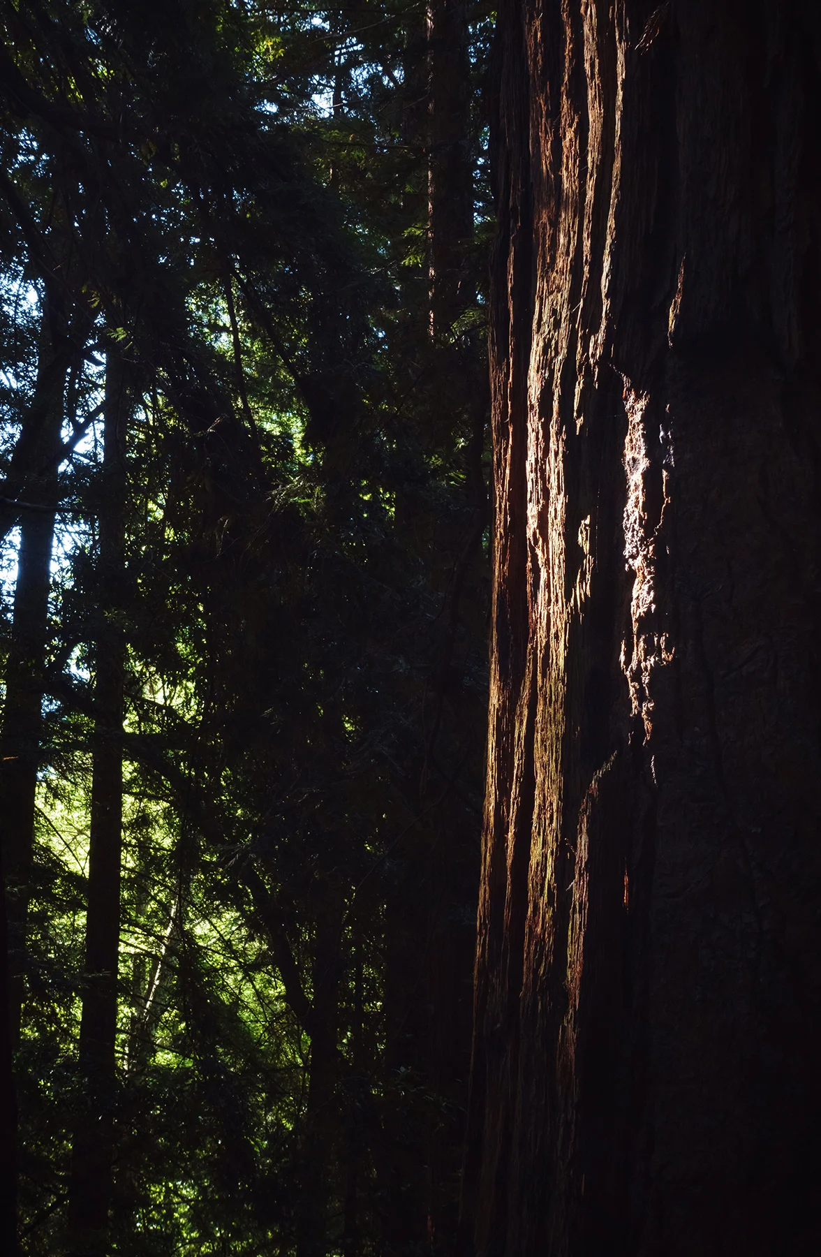
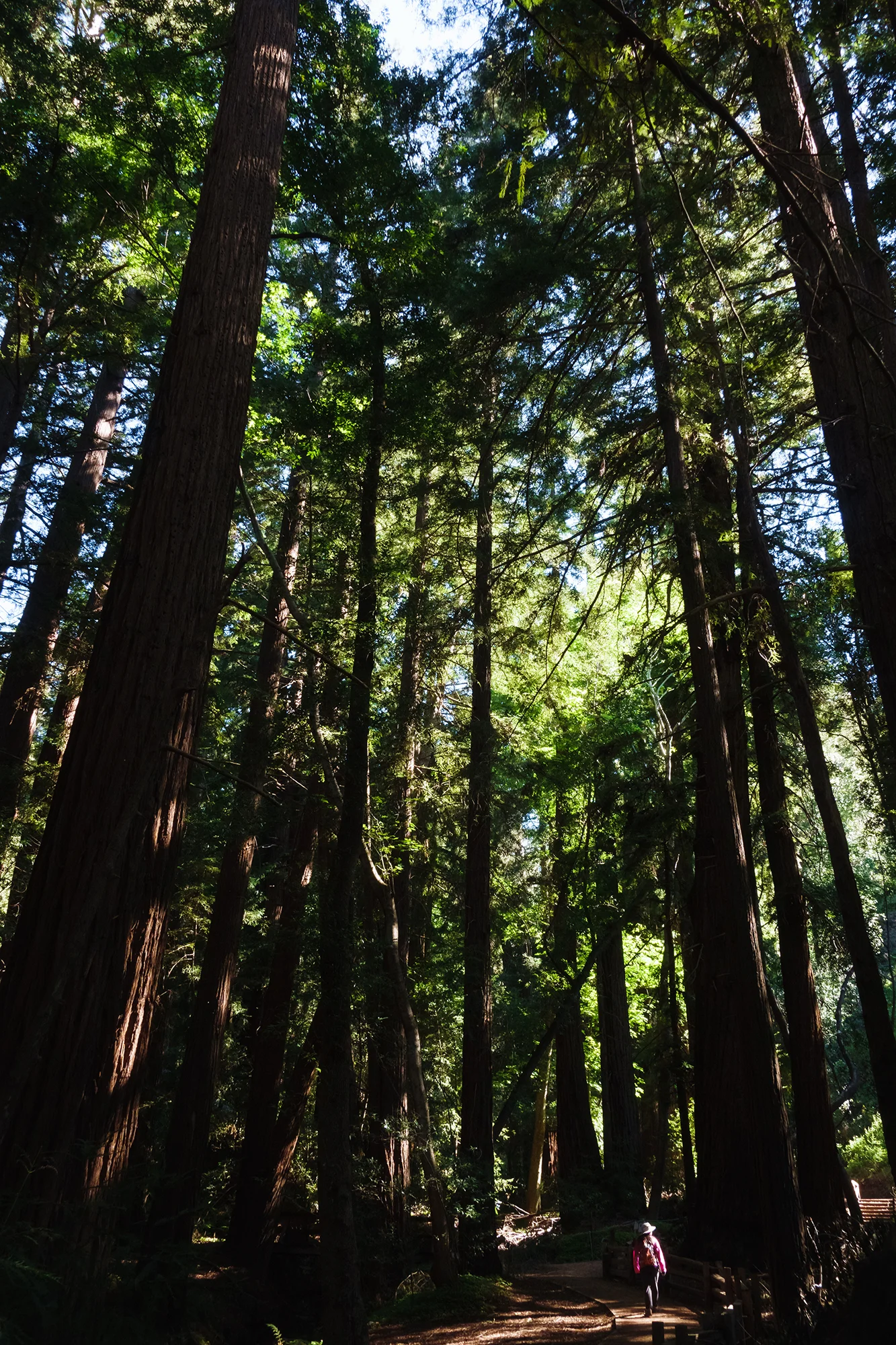
Afterwards, we drive the short distance back to our lodge at Pfeiffer Big Sur State Park. Leaving our car near the main office, we set off on the Valley View Trail, which follows Pfeiffer Creek through groves of coastal redwoods before switchbacking to a ridgeline east of the valley. Jane and I have some fun posing with these thousand-year-old organisms. The trees thrive in the Sur’s heavy winter rains and temperate, year-round fog, which condenses and provides moisture all along the height of their colossal boughs. At one bend in the path, Jane poses for a photo inside the trunk of a burnt-out redwood. The result is comically Lilliputian; wearing her field hat and pink windbreaker, she looks like a Columbia-sponsored human field mouse, huddled at the base of a hollow oak tree.
As the trail turns uphill, we leave behind the temperate rainforest world of redwoods, ferns, and clover carpets, and ascend into the sage scrub hillsides of the coastal range. Though the path is steep, the transition feels quite gradual, as the high branches and rich sienna bark of the redwoods continue to greet us switchback after switchback. Panting for air, we eventually make it above the treetops; the climb flattens into a ridge walk along the eastern rim of the valley. A mile later, we reach a west-facing overlook that serves as a breezy rest stop and turnaround point. The view across the valley, especially at mid-day, is nothing to write home about (dominated as it is by the highway), but there is a lovely glimmer of the blue Pacific to our northwest. As Jane and I pose for a selfie, I tear a hole in the butt of my hiking pants on a perfectly positioned sharp rock. Despite my wife’s protestations, I refuse to wear a different pair of pants for the remainder of our trip (or indeed, for the rest of our time with family in California).
After a water break and a snack, we retrace our steps back down the trail and return to the main lodge, where I order a vanilla ice cream float with orange cream soda; Jane has an iced tea. We also pick up our first of three (!) fridge magnets for this trip - an adorable image of Smokey the Bear with a beady-eyed fox and fluttery-lashed doe, presumably all smiling because of their confidence in our ability to not incinerate their natural habitat while we thoroughly trespass upon, trample, and develop it for our recreation. A high standard for ecological harmony. After we enjoy our drinks, we retreat to the cabin to eat lunch and settle in for an afternoon nap.


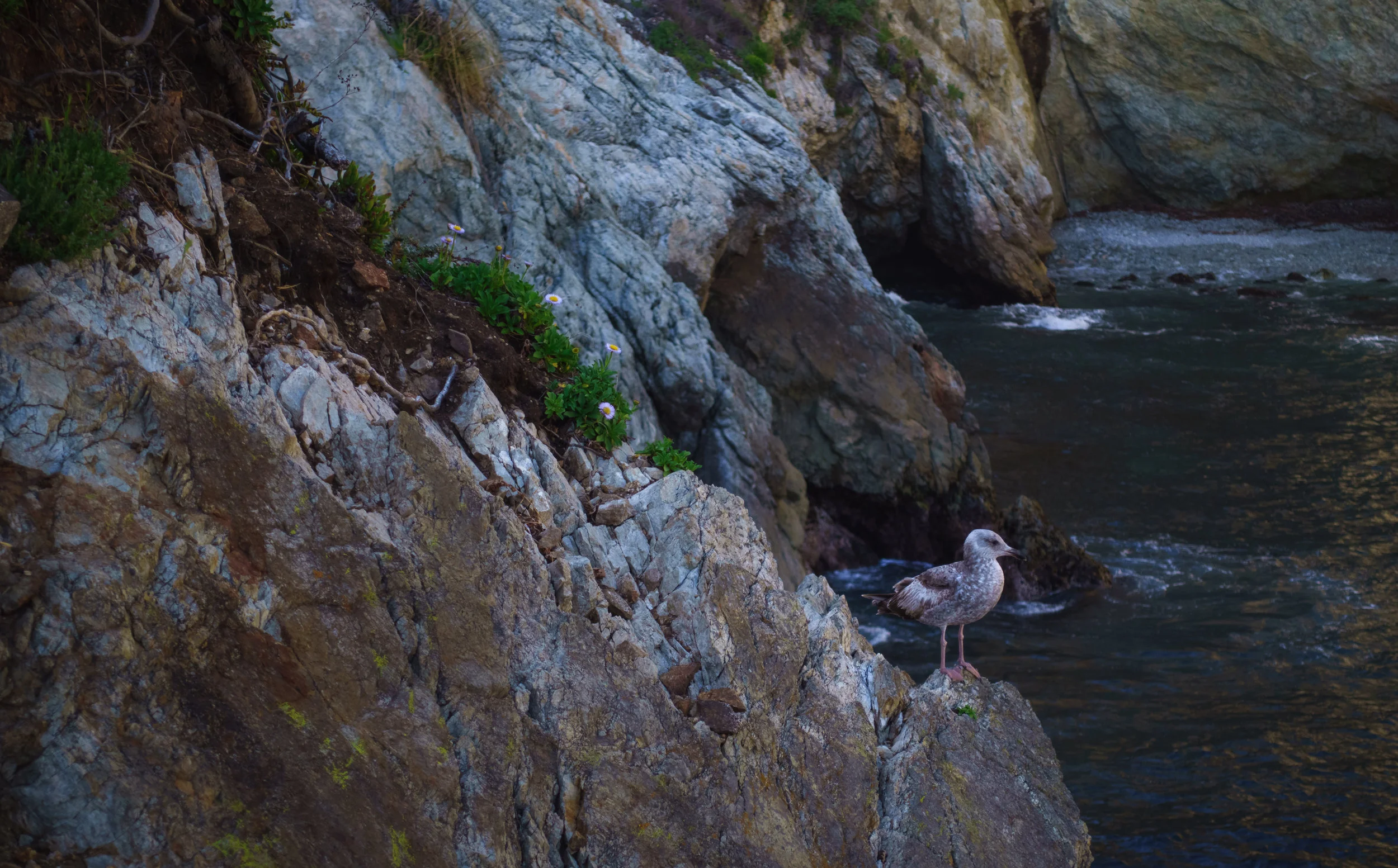
We leave the cabin again in the late afternoon, heading south to explore more of the winding coastline before we have to hustle for a sunset position at the famously picturesque McWay Cove. At the crest of Partington Ridge, we leave the car on a dirt shoulder and make our way down the canyon along a steep trail. At the bottom, the path levels off and follows the bank of a small creek before splitting toward a pair of rocky coves. Jane and I visit the southern cove first, which is accessed through a tunnel through the hillside - constructed in the late 1800s by homesteader John Partington’s for his oak harvesting business. Today, the landing is empty but for a few iron hoops drilled into the rock, and a solitary wooden bench looking over the water. We sit for awhile and are approached by an overly curious California gull, whose diet probably includes fish as well as sandwich scraps. On our way back, we visit the other cove, which is accessed by a narrow path through brush and ivy. The waves are booming on the boulders here, knocking over fancifully built rock cairns as the tide rises. As the afternoon sun vanishes behind the pines on the cliff above us, we make our way back up the canyon.
A short distance south on the road, we stop at a cliff-top vantage point with a classic Big Sur view: a winding coastline dotted by stately sea arches and hidden coves, with rolling foothills receding into a mist of marine fog. For a rare moment, I wish I had a camera lens with longer focal length, so that I could zoom in on the many lovely details in this landscape.


Past Partington Point, we come to a long and crowded shoulder in the road overlooking McWay Cove. As Julia Pfeiffer Burns State Park was heavily affected by mudslides and fires in 2018, the parking lot and short trail that lead to a vantage point of McWay Falls are still closed, and the roadside overlook is our only option to catch a glimpse of the famous waterfall. Truth be told, having seen the falls from the lower trail in 2012, I actually prefer the higher angle of view, which affords a more balanced composition of the entire cove, the waterfall, the surrounding cliffs covered with pine trees (to me, actually the most affecting and defining characteristic of the scene), and the blue horizon beyond. Fortunately, we arrive well before sunset, so I am able to get my tripod squared away in a nice corner of the overlook before a flood of photographers, smartphone wielders, and drone enthusiasts (seriously, so many drones) descends upon the scene. I take a timelapse of the changing colors and light, which dance across the falls and their surrounding cliffs as the sun falls in the west.
Leaving the waterfall overlook, Jane and I move the tripod thirty yards up the road to the side of our car, where there is a lovely, north-facing view toward Partington Ridge, with layers of coves and promontories in between. As the sun sets, it casts shadows across the beaches and cliffs, making for a mesmerizing scene full of depth and detail - honestly, a more impressive subject than McWay Cove itself. As is the case for so many high-traffic photography locations, we have this second overlook completely to ourselves, even though the scrum above the falls is just a few yards down the road. I take another timelapse here before we pack up the tripod and retrace our route toward home. As we enter Big Sur Valley from the south, from a high bend in the road, we’re surprised by a gorgeous sight: the day’s last light on the valley walls to our northwest. I quickly swing the car into a shoulder and hop out to take a photo from this impromptu overlook, just moments before the light fades. The glimpse of it is tantalizing enough that we decide to return here for sunset the next day - though the weather and lighting conditions would prove to be quite different on our third and final day in the area. For now, we make the brief drive back to the lodge, where we enjoy another ramen dinner before heading to bed early, in anticipation of a long day of exploration in the southern reaches of the Sur.


