Day 4: Uncompahgre Wilderness

It’s been a beautiful, productive few days of photography in the environs of Ohio Pass and Kebler Pass, but on Tuesday, it’s time for me to head west and see more of the wild landscape that Colorado’s Western Slope has to offer. First, in the morning, I make the short drive back up to Mt. Crested Butte’s ski condominiums before daybreak, to spend the morning golden hour on a hillside above town. It’s yet another unremarkable, virtually cloud- and drama-free sunrise, but I make the most of it while exploring a small desire path through the sagebrush, shooting the flanks of Mt. Emmons and the surrounding peaks as they glow pink from the rising sun. Back in town, I enjoy a relaxed morning, partaking the guesthouse’s breakfast of ham-and-egg croissants, pastries, milk, yogurt, and fresh-squeezed orange juice not once, but twice, while gradually packing and getting ready for the drive west to Ridgway. I am in no particular rush today, as the day’s itinerary calls for a meandering drive westward past Gunnison and the Blue Mesa Reservoir, then south through Cimarron and the Uncompahgre Wilderness, where I plan to catch sunset in a rather remote and difficult spot before finishing my drive late at night. No use in rushing, as long as I can be in position in time for a wilderness sunset.

In the late morning, I drive out from Crested Butte, taking the highway back south to Gunnison, where I fill up the tank before taking a stroll along the Neversink Trail, which parallels the Gunnison River. It’s another impressively sunny day, but the cottonwoods above offer a good bit of shade, and a splash of colors to boot. After a lazy walk by the river, it’s further west to the Blue Mesa Reservoir, where pink puffs of shaggy portulaca bloom on the shallow, sandy shore. In the car, I head west, passing by two sections of roadwork and bridge repair on U.S. 50 while enjoying my music in the car. Departing from the banks of the reservoir and the waterways of Gunnison country, the highway climbs into a narrow pass and emerges atop Blue Mesa and Fitzpatrick Mesa, where colorful scrub oak, rabbitbrush, and stands of aspen cover the plateau as far as the eye can see. Unable to stop the car along the twisting, winding highway, I forgo any photographs and capture the scene only with my eyes. A few miles further down, on the west end of the mesa, I turn off the highway and onto Big Cimarron Road, which carves its way up-valley into the heart of the Uncompahgre Wilderness.

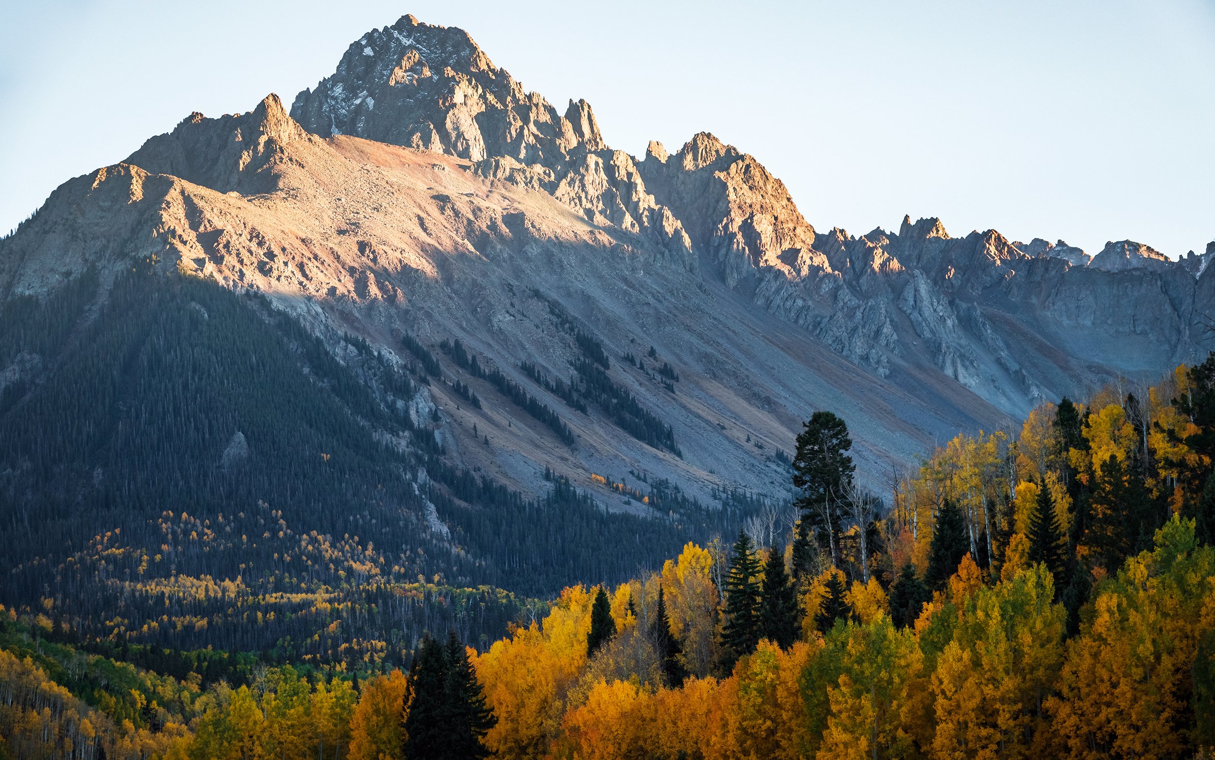
My main regret from this trip, aside from the preponderance of clear blue skies, is that I did not budget any more than an afternoon drive to explore the Uncompahgre Wilderness, a vast and isolated area of steep canyons, mountainous plateaus, and forested slopes centered upon the rocky massif of Uncompahgre Peak and its surrounding high summits. Big Cimarron Road cuts into the wilderness from the north, winding its way south along the valley until its reaches Silver Jack Reservoir and a network of dirt access trails that fade into the surrounding mountain passes. I stop at many points along the relatively maintained gravel road, shooting compositions into the heart of the wilderness with my long lens, which helps cut the blue glare and grey haze induced by the mid-day sun. Further south, the road passes a series of campgrounds and working ranches before arriving at the shores of Beaver Lake and Silver Jack. At Silver Jack, I enter the day-use area, taking a short walk down through a beautiful aspen grove to reach the path around the reservoir. Standing atop a boulder above the forest, I find a wonderful panoramic view of the reservoir and the surrounding hillsides - covered in golden aspens, with the craggy outlines of Courthouse Mountain and Sheep Mountain in the distance, beyond the winding shoreline. Once again, I’ve managed to hit upon excellent foliage conditions here in Uncompahgre - indeed, some of the best leaf colors that I’ll see for the rest of the week.

Back in the car, I continue along the dirt road as it meanders south between the mountain chains, ultimately climbing through forest and turning westward into the Owl Creek drainage. At the top of Owl Creek Pass, I reach the trailhead for my final walk of the day.

When I say, “trailhead for my final walk of the day,” I need you to understand that ‘trailhead’ is a significant overstatement, just as ‘walk’ is a significant understatement. I’ve arrived here a full two and a half hours before sunset, precisely because my next objective involves a steep, uphill bushwhack through the forest, to a clearing overlooking the aspen groves of upper Owl Creek Pass and the mountains of the Uncompahgre Wilderness. Following the contours of the topo map on my phone carefully, I pick my way over, under, around, and in some cases through the jumble and deadfall of the untrammeled forest, making gradual progress along the ridge north of Owl Creek Pass - up one hill using my hands and feet, panting and sweating the entire way, then down, then up again. A few times, checking my progress against the time, I nearly decide to turn around and abort the walk, worried as I am about how deadly this bushwhack will become after nightfall. But I decide to press onward, extremely slowly and carefully, in the hopes that I won’t be alone on the ridgetop and might have company on the journey back down. Despite taking care of where I step, I get at least one or two lashes on my leg from sharp tree branches and downed barbed wire fencing - thankfully, no puncture wounds or significant injuries. After a final steep, breathless climb, the open sky emerges through the golden canopy, and I reach the overlook ridge at last.

I’m joined over the next hour by a few other intrepid photographers who made the climb through the forest — most of us having started from various places on either side of the pass, apparently none of them any easier than what I just endured. We set up our cameras carefully on the open ridgeline, using rocks and backpacks to anchor tripod legs onto the steep, loose slope. One hiker climbs the rocky bluff to the right (south) of the ridge; we gasp as she nearly loses her footing shimmying around the fully vertically-exposed cliff face; a pile of loosened rocks goes hurtling off into space, landing with a shuddering crack in the forest below. After exhaling a collective gasp (alongside the line of photographers who nearly recorded a fatality), I take a shot with the hiker overlooking Owl Creek Pass.

After a long period of sitting, chatting with other photogs about our individual adventures, and tending to my timelapse, the sun begins to fall to the west of Owl Creek Pass, bathing the intervening aspen forests, and the flanks of Courthouse Mountain, in a maroon-and-gold glow. Packing my tripod and donning my wind layer and headlamp for the journey back down the hill, I fall in with a fellow photographer from North Carolina. The two of us decide to stick together for the long, dark descent back to our cars. The return, harrowing as it is to pass through the deadfall with only our headlamps, is made a lot more bearable by safety in numbers - although we do spot an ominous pair of glowing eyes at one point (some sort of fairly large mammal in the darkness), and toward the end, we manage to veer off-course onto the eastern side of the ridge and wind up having to slog partly back uphill to our vehicles at Owl Creek Pass.

Back at the car, after saying farewell to my walking companion, wiping off, rehydrating, and doffing my sweat-soaked beanie and dirt-crusted gloves, I make the long, bumpy drive down the road from Owl Creek Pass westward to US 550. It’s a somewhat creepy drive in the darkness - made worse by the knowledge that I am fairly isolated out here, many miles from civilization, with zero cell coverage, and unlikely to find help for hours if I puncture a tire or suffer any other car trouble. To compound matters, my GPS unit keeps pointing me toward odd turns onto various dirt offshoots which appear scarcely more than hiking trails crisscrossing the wilderness - a recipe for a disastrous survival situation, if I ever knew one. Fortunately, I studied the area map carefully before my trip, and have grown over the years to be naturally distrustful of the old Garmin’s bizarre fetishes and fallacies. After a long and careful drive, shortly after 9 PM, I exit the county road and pull onto the highway; a few minutes later, I reach town, where I settle in for the night at Mtn Lodge Ridgway. A long shower, a careful wash of the tree-lashed nicks and bruises on my lower legs, and a hot bowl of noodles later, I climb into bed and fall into a deep, well-deserved sleep.

Day 5: The San Juan Mountains

So it’s onward to the latter half of my trip, where I’ll be exploring the backroads and highway passes of the San Juan Mountains, focusing most of my time on Ouray County and the north front of the Sneffels Range, just outside of Ridgway. On Wednesday morning, my main objective is to drive the Million Dollar Highway, the stretch of US 550 that heads south from Ridgway, winds into Red Mountain Pass between Ouray and Silverton, and then to the top of Molas Pass, sitting high at 10,910 feet above sea level in the San Juan National Forest. In hindsight, it might have been better to start the week’s trip here for better foliage conditions, as many of the aspen groves surrounding Ouray and Ridgway have already become barren and windblown; however, it’s all a fair deal in the end, as I would not have traded anything in the world for the past few days of glorious shooting around Crested Butte and Kebler Pass.

In the morning, before sunrise, I set off southward out of town, passing through Ouray’s sleepy main street and climbing up toward Red Mountain Pass. At the roadside overlook for Bear Creek Falls, I briefly stop to admire the waterfall and photograph the view up Uncompahgre Gorge. A few miles down the road, I stop by Crystal Lake, where the faint colors of sunrise on Red Mountain and the placid movement of waterfowl upon the lake’s surface exist totally in contrast to the firing squad of a photography workshop (the first of several I’ll encounter in the coming few days) gathered upon the lakeshore, and the rumble and drill of the construction crews hard at work across the road. I stick around long enough to photograph first light on the mountaintop, then stroll briefly to the western shore of the lake, where I frame some nice telephoto compositions involving Red Mountain, Darley Mountain, and the pencil-smudged aspen groves on their hillsides.

Down the road, the highway climbs into a series of hairpin turns near the famous Red Mountain Pass. Although reportedly treacherous in rain or winter conditions, the pass is eminently driveable on this calm, breezy (and yet again totally cloudless) autumn day. Near the top of the hairpins, I stop for a look back down the valley, and some lovely shots of morning light breaking over the wall of the mountains to the east. Then, it’s further south to the other end of the pass, where the road descends into another valley as it makes its way toward Silverton. I decide not to stop in Silverton, continuing onward to Molas Pass, where I stop at a few overlooks to photograph the forest, the mountains, and a distant cabin on a plateau, which acts as an object of interest.

At Molas Pass, I reach my turnaround point for the morning. The overlook here is a stunning panorama ranging from the north to the east and south, covering alpine plateaus, rugged mountain peaks, and glistening, jewel-like lakes studding the landscape. If it were earlier in the trip (if my legs were fresher) and the sun weren’t so glaring and oppressive, I would have loved to wander down the plateau and take a walk into this idyllic landscape. However, achy and sore as I am from yesterday’s wilderness hell-climb atop Owl Creek Pass, I settle for quick detour to the shore of nearby Little Molas Lake, before making the drive back to Ridgway. The return drive is mostly uneventful, save for spotting a tall moose buck moseying along the highway just outside of Silverton. At the hotel, I get a takeout lunch from the Million Dollar Roadhouse restaurant downstairs (a smoked beef brisket sandwich with fried shallots, au jus dip, and fries - yum!) and settle in for a mid-day rest. Television and a nap to escape from the sun — yep, it’s that part of the vacation week, already.

In the afternoon, I head out west from Ridgway, planning to scout some of the dirt roads that branch off of CO-62 into the Mt. Sneffels Wilderness. To my disappointment, I find that much of the area, similar to the mountains around Ouray, is quite patchy in color - the mountainous roadside vista at the Dallas Divide, gazing toward the Sneffels Range, appears scattered, and while there are groves of colorful oak and aspen on the hillsides, many of the treetops are barren and the scene looks mostly windblown at best. Undeterred, I continue onward to Last Dollar Road, a long gravel drive that cuts through the mountains southward to Telluride. Only the first six or seven miles of the north side of Last Dollar Road are passable in my rental car, but these include some beautiful open landscapes, airy views toward the mountains, and working ranches which provide foreground and midground interest. I spend the hour or two before sunset casually scouting along the road, getting out of the car a few times to document the beautiful scenery and the autumn foliage.

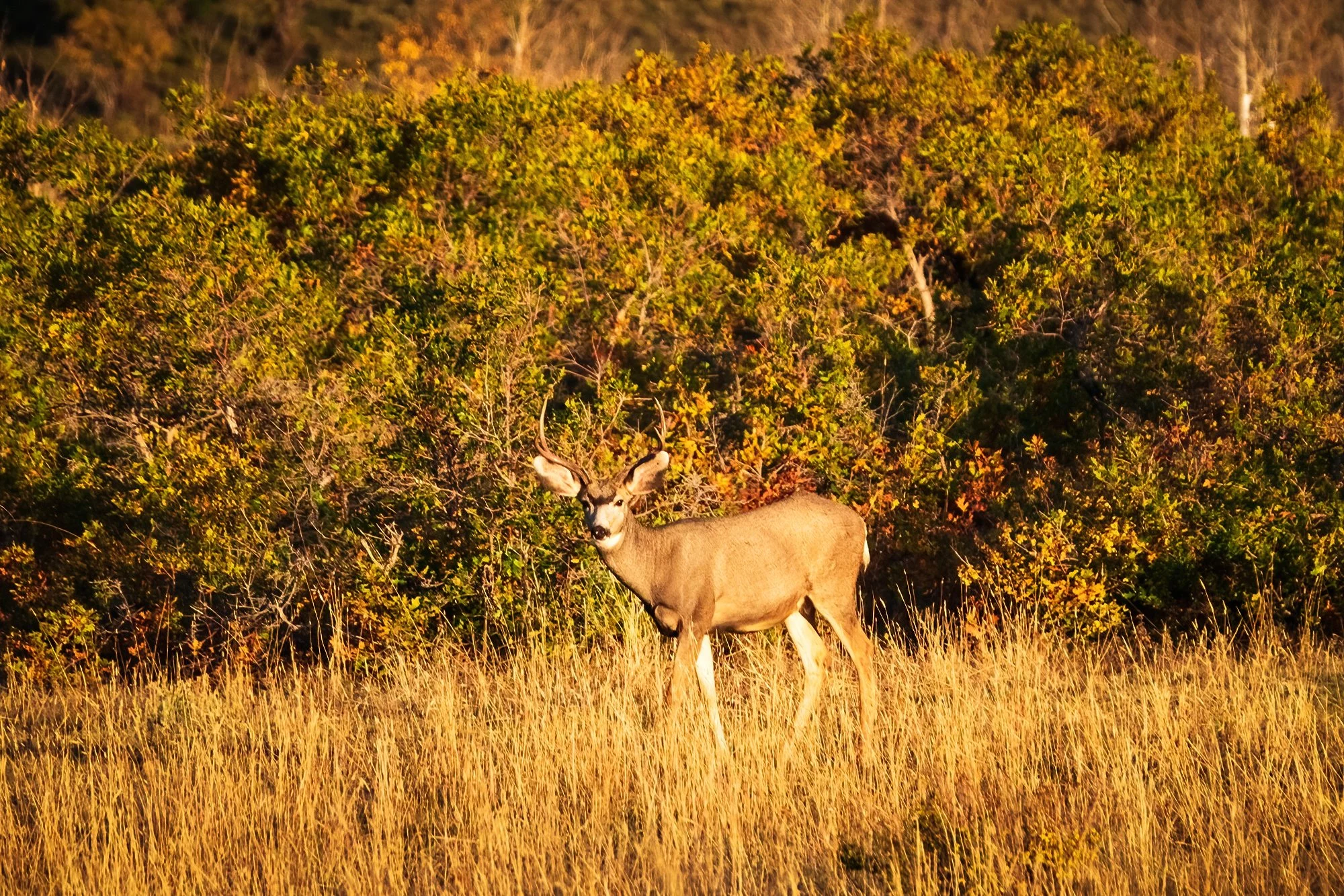
At the start of golden hour, I make my way back to a spot just a few miles from the highway, at the edge of a large meadow near a ranch’s fenceline. Here, there is a broad sweeping view of the mountains to the south, and the play of sunset on the distant hillsides makes for wonderful light conditions. I set my tripod up just behind the fence, and it fires off a timelapse while I pace about with my main camera (including accidentally walking into the timelapse for a handful of seconds before I notice my stupidity…). With the long lens, I capture many things over the subsequent hour: a Cooper’s hawk that swoops down and perches in a nearby tree. A trio of whitetail bucks browsing in the nearby scrub oak, stopping once in awhile to stare in my direction. Reflected sunset light from the window of a distant cabin. A panorama of the ranch road leading into the mountains. Then, from a hillside to the west comes the bark of an Rocky Mountain elk; using my camera, I spot an entire herd, which gradually makes its way down to the nearby meadow. With my long lens propped up against a fence post for stability, I take one of my surprisingly favorite images of the entire trip - a photograph of the elk herd grazing beneath a rainbow hillside of scrub oak, with a small grove of barren white aspen trunks forming the central interest in the scene.

As the sun sinks lower toward the horizon, I eventually pack up the tripod and head back eastward into town. It’ll be a full day of exploring the Sneffels Wilderness tomorrow - largely, but not only, from the comfort of the inside of my car.

Day 6 & 7: The Sneffels Range

Thursday morning. It’s getting progressively harder to drag myself out of bed for sunrise, but I manage to do it anyways, in spite of the blasé weather reports (even more sun, even more clear skies… woo hoo) and past-peak condition of the local aspens. My destination for the morning is only a short drive away - the roadside overlook at the Dallas Divide, where CO-62 crests a high saddle between the San Juan Mountains to the south, and the Uncompahgre Plateau to the north. In the pre-dawn darkness, I find that the big gravel pullout on the other side of the highway is pretty packed - another workshop group has found its way here first. I set up near the end of the tripod line, and the other photographers and I watch as the sun rises over the Uncompahgre Wilderness to the east, cresting the high summits and gradually painting the Sneffels Range in early morning light. Though parts of the intervening slopes are barren, the glow of the morning sun covers this up nicely, and the scene is soon suffused in warm, beautiful light. I work a variety of close and long compositions including the mountains and the trees. No clouds in the sky, nor snow on the peaks - but the landscape is still quite lovely, nevertheless.

The rest of the morning is spent gradually working my way eastward back toward Ridgway, turning off onto the various county dirt roads that cut into the foothills below the Sneffels Range, and poking around for interesting scenes and compositions. County Road 9 is the first such turn-off, just a few miles to the east of the Dallas Divide. The road cuts through the Double RL (Ralph Lauren Ranch), featuring impressive views of the mountainous wall to the south. However, the aspen groves further up the road are pretty spotty, and I fail to see much worth coming back during sunset or sunrise. I turn around near an old, apparently abandoned cabin just before a construction site by the edge of the road, and move onward to the east.

County Road 7 is next to the east. The drive up involves an easily passable but increasingly bumpy dirt-and-gravel ride approximately seven miles uphill. Along the way, I photograph the reflection of the mountains in a roadside pond, and continue onward to the border of a meadow below Mt. Sneffels, where I decide to pause for photographs. Here, a stand of brilliant aspens provides a nice foreground element, while the mountain cirque flares outward like an amphitheatre in the background. After taking some scout shots and admiring the foliage, I decide to come back to this location for sunset tonight — perhaps the last and best bit of autumn color on this side of the San Juans.

Almost back in town, I turn off the highway and drive past a few residential blocks before turning uphill again along County Road 5. This dirt road is the best-graded of the three, and it’s an easy ride to the top another plateau that offers sweeping views of Sneffels Range from a slightly different perspective, with Mt. Sneffels itself further back and to the right of the scene compared to the direct view on CR-7. After scouting around this road as well, I decide to return to the end of this road, in front of a large open field by the roadside, for sunrise tomorrow. It’s late morning now, and the sunlight has become increasingly harsh and ugly for large landscapes. I beat a hasty retreat back to Ridgway and grab another takeout brunch - this time, a breakfast platter of eggs, sausage, and home fries from Greenwood’s across the street - before returning to my hotel room for my lazy mid-day rest.

In the afternoon, after filling the car’s tank again and airing up the tires (one of which has sprung a pesky tire pressure warning since the cold of early morning), I make my way back west to County Road 7, and meander up the dirt road toward Mt. Sneffels. I stop again at the roadside pond, where the light has changed significantly since the morning (and the pond reflection has disappeared beneath a pesky breeze), but it is quite beautiful nonetheless. After admiring the scene and stopping to identify some of the local flora, I continue up the road. Just before the meadow overlook, I pause by the roadside to photograph some of the aspens on the hillside to my right (west), which are beautifully backlit in the afternoon sun. Then, it’s onward to the sunset spot.

Unsurprisingly, I am joined by quite a few other vehicles (and their occupant photographers) in the road curve above the meadow. An(other) entire photography workshop follows shortly thereafter. Thankfully, everyone is quite gracious and jovial, and mindful of each other’s equipment as we pick our tripod spots above the meadow. After setting up my timelapse, I start by shooting various compositions of the nearby aspen trees with golden backlight, before moving on to the mountains and to other parts of the meadow. One of the workshoppers is kind enough to keep an eye on my tripod and my backpack, enabling me to jog a short distance further down the road, where the valley view opens up somewhat, and the amphitheater-like appearance of the mountain wall becomes much more apparent. I take some photos of this mountainous wall and its snowfields, along with a somewhat unhealthy number of panoramas, before returning to my tripod position to finish out the afternoon. I thank my elderly workshop neighbor for watching my stuff, and repay her by sharing some intel about the view further down the road; on my advice to focus more on the mountains and less on the meadow (which has already fallen into shadow by now), she relocates shortly thereafter. As the sun’s last light reaches the summit of Mt. Sneffels, I clamber back into the car, eager to get a headstart back downhill and back into Ridgway for dinner and an early night.


On Friday, my final day of exploring around Ridgway before heading home, I catch one last sunrise beside a field near the end of County Road 5, where I’m joined by a herd of grazing cattle (none too excited to be disturbed by us photographers, our cars, and our clackety-clack tripods). The view is fronted by a forest of aspens in the mid-ground (again, patchy in their yellow, green, and barren-white appearance after several nights of high wind) with Mt. Sneffels looming to the west, in the background. There are no workshop groups with me this morning - just one or two other photographers who work the scene and move on shortly after daybreak. After setting up my tripod, I too walk around, composing different shots with my long lens and the distant mountains. Overall, it’s yet another ho-hum sunrise (indeed, nothing I’ve seen all week has compared to the dramatic sunsets I saw earlier in Kebler Pass), but the air is fresh and it’s a treat to be outside and well away from all vestiges of my normal life; I’m fine with savoring it for just a little while longer. After dawn, I take my singular trip selfie against the fence above the field. Then, it’s back into town; on the way downhill, I briefly stop to shoot a long telephoto shot toward Owl Creek Pass and Courthouse Mountain, miles and miles above Ridgway in the distance. I make a mental note to try for a similar composition closer to sunset, when the rock wall to the town’s east will be lit by the setting sun.

Back in Ridgway, I pass most of the mid-day hours reading, resting, watching TV, and napping in my hotel room, happily enjoying my vacation (it’s my damn vacation!) now that the lion’s share of the landscape photographing and the being artistic and adventurous and creative-ing is done for the week. In the afternoon, I hop in the car and pop a few blocks to the west (past the single stoplight intersection in town) and leave the car parked at Hartwell Park, a delightful little green space where tall, old oaks grow above the town’s central square. After checking a few restaurants, I eat an early dinner at El Agave Azul (a delicious fajita platter and a big mug of ice-cold horchata) before taking a walk back down Sherman Street, to the road bridge that leads out of the town. Here, I set up my penultimate timelapse of the trip: a view of the Uncompahgre River as it curves its way out of town, with the buildings and cottonwoods of the nearby ranch in the mid-ground, and the eastern end of the Sneffels Range looming above in the back. Naturally, since it’s my final night in Colorado and I’ve decided not to leave town, this is also the first time in five days that there have been clouds in the sky at either golden hour. No matter, I say to myself. It is quite obvious to me that if I were to drive up into the mountains along one of the county roads, the clouds would surely vanish or become mispositioned, and I’d be photographing another sunset-mediocrity sandwich. Such is the luck, and the self-protective logic, of the jaded landscape photographer. I make do as best as I can, getting some lovely simple shots of the river and the distant mountains.

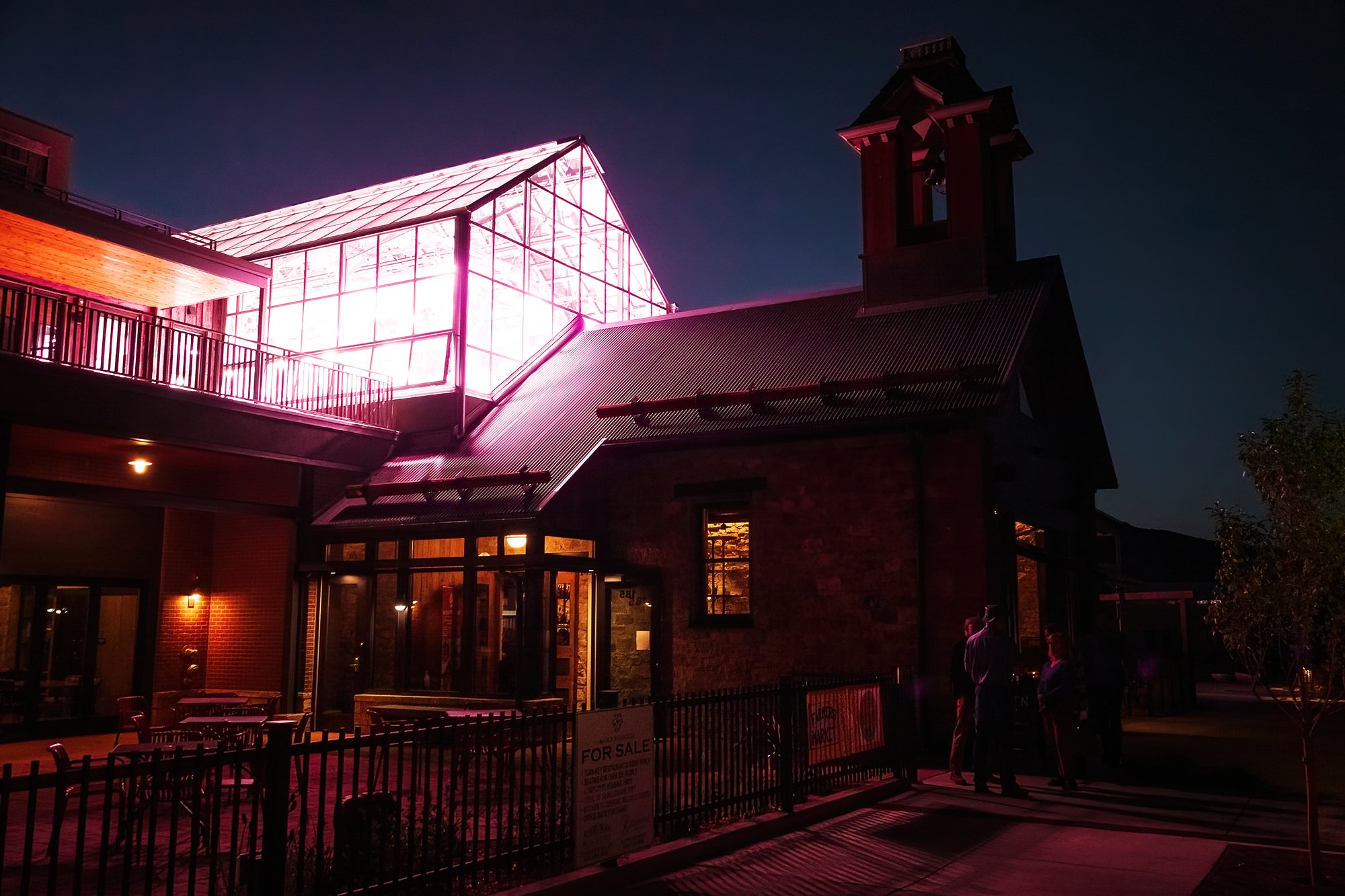
After taking a brief timelapse from the bridge, sensing an opportunity for a second shoot before sunset, I quickly jog back to the car and relocate up the road, to a quiet residential sidewalk on the west side of town, where I capture some footage looking eastward toward Owl Creek Pass and Courthouse Mountain as they catch the fiery rose colors of the day’s last light. As the sky grows dark and evening sets in, I make my back to Hartwell Park, wanting to spend a bit more time walking around Ridgway’s main strip at night. I take a few photos during my blue-hour meander around town, admiring the storefronts, the cozy-lit restaurants, and the Spanish faux-colonial architecture lit by string lights and street lights at dusk. It’s a cute place, and I’m glad I got to visit and see it in a fine mood and a good season. Then it’s back to the car (traipsing across the grass below the oaks in the park, which is now lit by tiny warm lanterns), and back across the highway intersection to the hotel for one final night.

In the morning, after packing the car and leaving my keys at check-out, I make a breezy, fun drive (playlist blaring, cruising along and clocking in just under two hours) from Ridgway up to Grand Junction, where I’ll catch my return flight to Boston via Denver. Grand Junction’s main boulevard to the airport has hardly changed from what I remember over three years ago, when Jane and I flew out here and drove to meet Lindsey in Moab in April 2021. The nostalgia hits right down to the Denny’s where I grab brunch before my flight, which becomes suddenly familiar the moment I make the left turn over double-yellow lines and two lanes of traffic into its parking lot. Jane and I made the same turn into this parking lot in 2021, but we ultimately had to skip out of the sit-down meal due to a long wait (unacceptably long, amidst the COVID-cautious state of the world at that time), and we ultimately went through a Wendy’s drive-thru and ate in a parking lot just down the road instead. After a long layover in Denver (featuring not one, but two Jamba Juice smoothies - once again, it’s my damn vacation), I’m return home to Boston late Saturday night, with my longest solo photography trip (well… at least, as a semi-professional adult) under my belt.